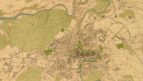
Since the foundation of the city in 1191 the settlement area has expanded time and again. While it was still limited to the loop of the river Aare at the beginning of the 19th century, a working class district emerged in the „Lorraine" after the construction of the first railway bridge in 1858.
The building of the bridge „Kirchenfeldbrücke" in 1883 and of the bridge „Kornhausbrücke" in 1898 led to a further development of the settlement area. Finally in 1919 the city was enlarged westward by the integration of Bümpliz. All these changes can be tracked on the city maps.